Namibia · Regions · Desert, coast, savannah, rivers · Capital: Windhoek
Namibia is a country of huge distances and very different landscapes: the dunes of the Namib, the fog coast, the rock deserts of the north-west, the savannah around Etosha, the green river strip of the Zambezi and the canyons of the south. Here is each region, with travel times, honest tips and what most itineraries leave out.
Search our Network. Start here.
The capital is small, orderly and the starting point of most trips — Hosea Kutako airport lies about 45 kilometres east. See the Christuskirche, the Alte Feste and the Independence Memorial Museum, the Parliament gardens, the craft centre, and Katutura, the township created under apartheid — best visited with a local guide, for its markets and kapana grilled meat.
Germany warns that robberies in Windhoek happen especially on Sundays and public holidays when fewer people are around — including walkers on the edge of town (Avis Dam, Lovers Hill) and in the city centre.
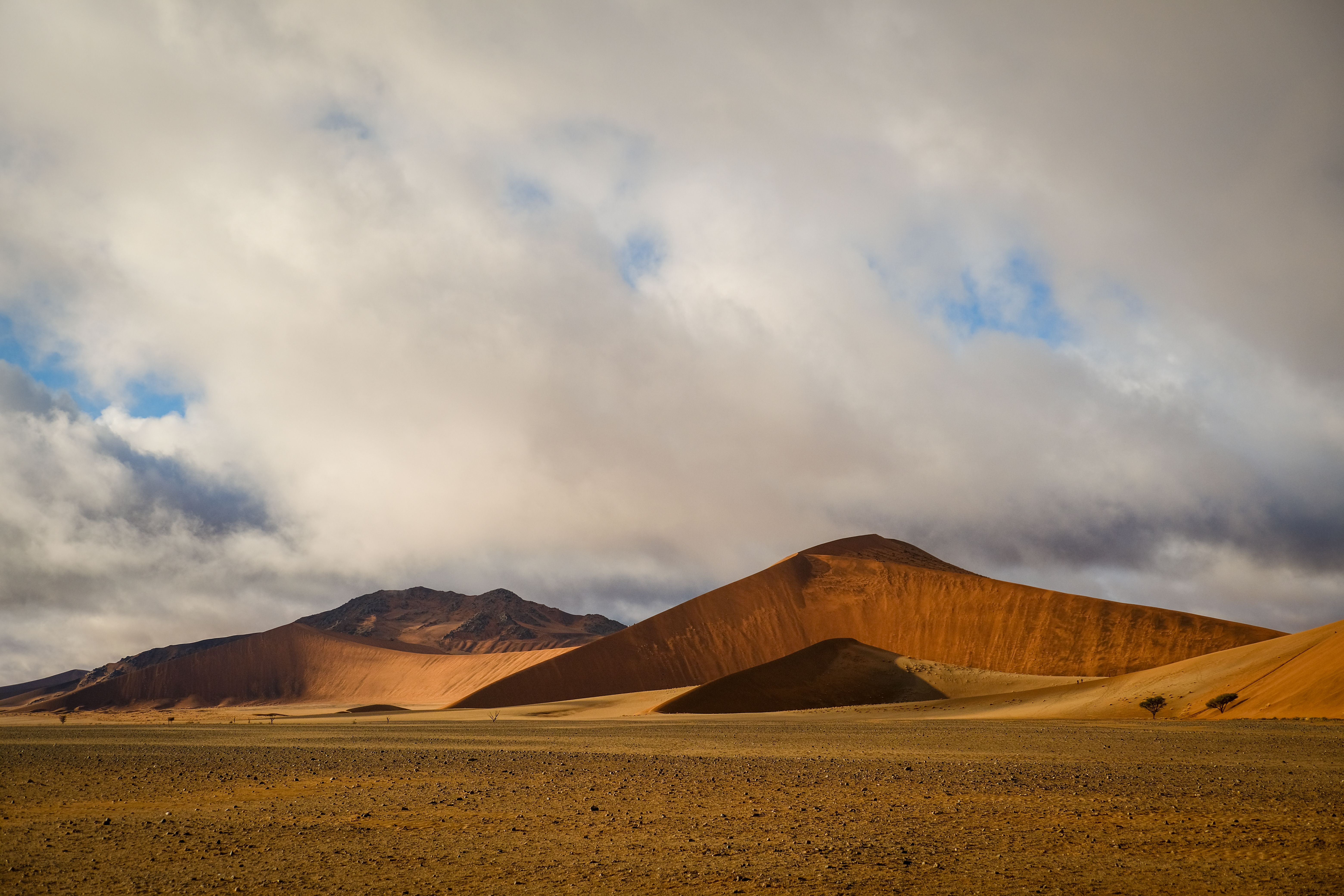
The Namib Sand Sea, a UNESCO site, has some of the highest dunes in the world. At Sossusvlei, red dunes surround white clay pans; Deadvlei's dead camel-thorn trees are hundreds of years old. Climb Big Daddy or Dune 45 at sunrise and visit Sesriem Canyon. Sossusvlei is roughly five hours from Windhoek by road, much of it gravel. Further south, the NamibRand reserve is a dark-sky reserve.
Honestly: the gates open at sunrise and everyone rushes for the same dunes. Stay inside the park gate if you can, and carry plenty of water — temperatures soar by midday.
Swakopmund looks like a German seaside town dropped in the desert — half-timbered buildings, bakeries, German spoken in the shops — and is the base for quad biking, sandboarding and the "Living Desert" tours. Walvis Bay, with its flamingos and seal and dolphin boat trips, was South African until 1994. North of Henties Bay, the Skeleton Coast is a fog-bound coastline of shipwrecks and seal colonies, such as Cape Cross. The Atlantic is cold, the fog common.
The rugged north-west holds Twyfelfontein, the Brandberg, the Petrified Forest and desert-adapted elephants. Further north, Kaokoland is home to the Himba, whose villages are often visited by tourists. Go only with a guide who works with the community and agree beforehand what the visit gives back — some "Himba tours" are little more than photo stops.
Etosha National Park is the country's great wildlife park, about five hours north of Windhoek. North of it lies the most populated part of Namibia, the Ovambo heartland around Oshakati, Ongwediva and Ondangwa, with markets, homesteads and the historic Nakambale museum at Olukonda — rarely visited by tourists and well worth a detour.
Germany advises always making sure of sufficient fuel, especially on the way to Etosha and remote regions, as some lodge petrol stations have had little or no fuel.
The north-east is green and wet: the Okavango River, Bwabwata and the parks of Nkasa Rupara and Mudumu with hippos, buffalo and birds. The Zambezi Region — formerly the Caprivi Strip, a colonial border oddity named after a German chancellor — leads to Katima Mulilo, Botswana and Zambia, and on to Victoria Falls. This is malaria country; see Zambia Vibes for the next step.
The Fish River Canyon is one of Africa's largest canyons, with a five-day hiking trail open in the cooler months. On the coast, Lüderitz has colonial buildings, cold seas — and Shark Island, site of the genocide's deadliest camp. Nearby lies the ghost town of Kolmanskop and, on the road there, the wild horses of Garub.
Red sand and camel-thorn trees east of the main road: lodges near Mariental and Stampriet, and the San communities around Tsumkwe in the north-east, where Nyae Nyae Conservancy offers community-run visits. Next door lies South Africa.
Desert trips to Sossusvlei, Etosha and the coast, a Walvis Bay cruise, and transfers from Hosea Kutako airport. Entrance fees are included in the tour price. Tips for guides and drivers are not included, but they are welcome.
Tour links are affiliate links: if you book, we may earn a small commission at no extra cost to you.
Page updated . Travel times are estimates; road conditions change. All text © Remo Kurka.